Day Paddles
South Tampa Bay
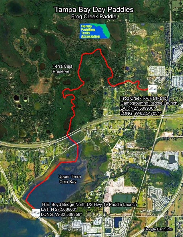
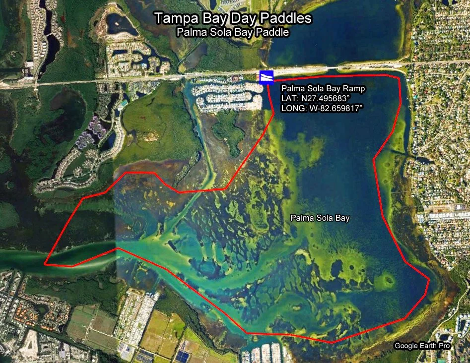
All Maps and Info Sheets are downloadable and printable in an 8.5 X 11" format. For more information on mentioned boat ramps and paddle launches, please see Launch Sites and click on the icons for additional details.
Download and Print Instructions:
Maps: To print out maps in full size, please left click on map below to pull up full size map, then right click on full size map and choose “Save Image As”. Save to your desktop or designated folder. Print from there.
Info Sheets: To print out Info Sheets, please click on the green Info Sheet button, then right click on the Info Sheet and choose “Save As”. Save to your desktop or designated folder. Print from there.
KMZ: For trip planning and navigation. To download the KMZ track file, click on the KMZ button. Once downloaded, locate the file on your computer and click on it. The file will then open in Google Earth. You must have the Google Earth or Google Earth Pro app on your computer or device. KMZ routes are for general navigation purposes only and may need to be adjusted for tidal and weather considerations.
Garmin Navigation User Instructions: The downloaded KMZ file can be directly uploaded to Garmin’s Homeport or BaseCamp app (Garmin Explore app for Garmin InReach devices) and then downloaded to any Garmin GPS device.
iPhone Navigation User Instructions: https://www.floridapaddlingtrails.com/iphone-cell-phone-navigation
Android Navigation User Instructions: https://www.floridapaddlingtrails.com/android-cell-phone-navigation